July 24, 2021
Today is Saturday, and I gave my feet the pleasure of a walk around the Waitsfield Farmer’s Market and a short stretch of the sidewalk, crossing Main Street twice. The past week, they have propelled me along roughly forty-six miles of hiking in the Green Mountains and the Champlain Valley. Not accustomed to that much confinement in my waterproof boots, I chose to wear my sandals for the 8.5-mile road walk across the Champlain Valley yesterday. Feet management is an important consideration I have learned. “I give my feet at least 12 hours off every day.”, said Denali, a long-distance hiker and my companion hiker for Sunday, Wednesday, and Friday. This is an update on A Day in the Moosalamoo with Denali, detailing her adventure traversing the North Country Trail in Vermont.
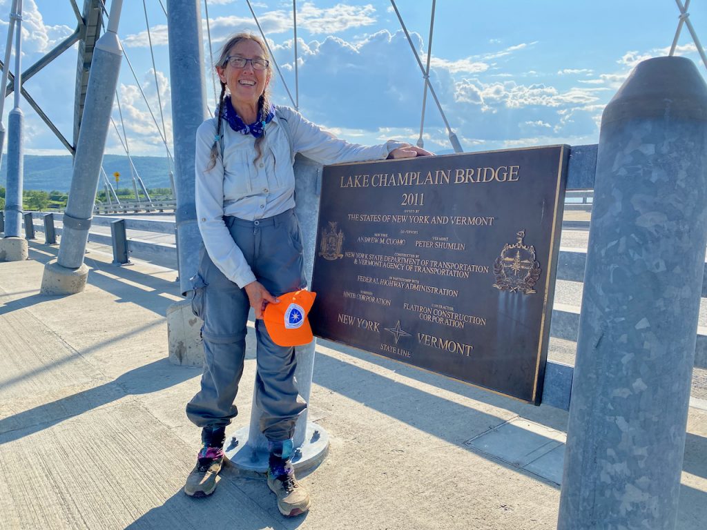
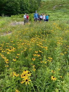
Denali is safely on her way in New York State, having crossed the Champlain Bridge at around 5:00 p.m. yesterday. We met up early in the morning in Weybridge for the final stretch of her Vermont journey. Last Sunday, I left Denali at the Sucker Brook Shelter, just up the side trail from the Moosalamoo National Recreation Area. For three days, she hiked and camped on the Long Trail, heading south to Maine Junction, the eastern terminus of the North Country Trail and the Junction of the Long Trail and Appalachian Trail. While Denali was heading south on the LT Tuesday afternoon, I joined fellow Peak-a-Week Club members for a hike of Burnt Rock (LT summit south of Camel’s Hump). We were chased down early due to impending wide-spread heavy thunderstorms marching steadily across the Champlain Valley. Thankfully, the PAW gang reached the lower-angle approach before we got wet. Denali and I felt the reach of that storm even though we were several walking days apart.
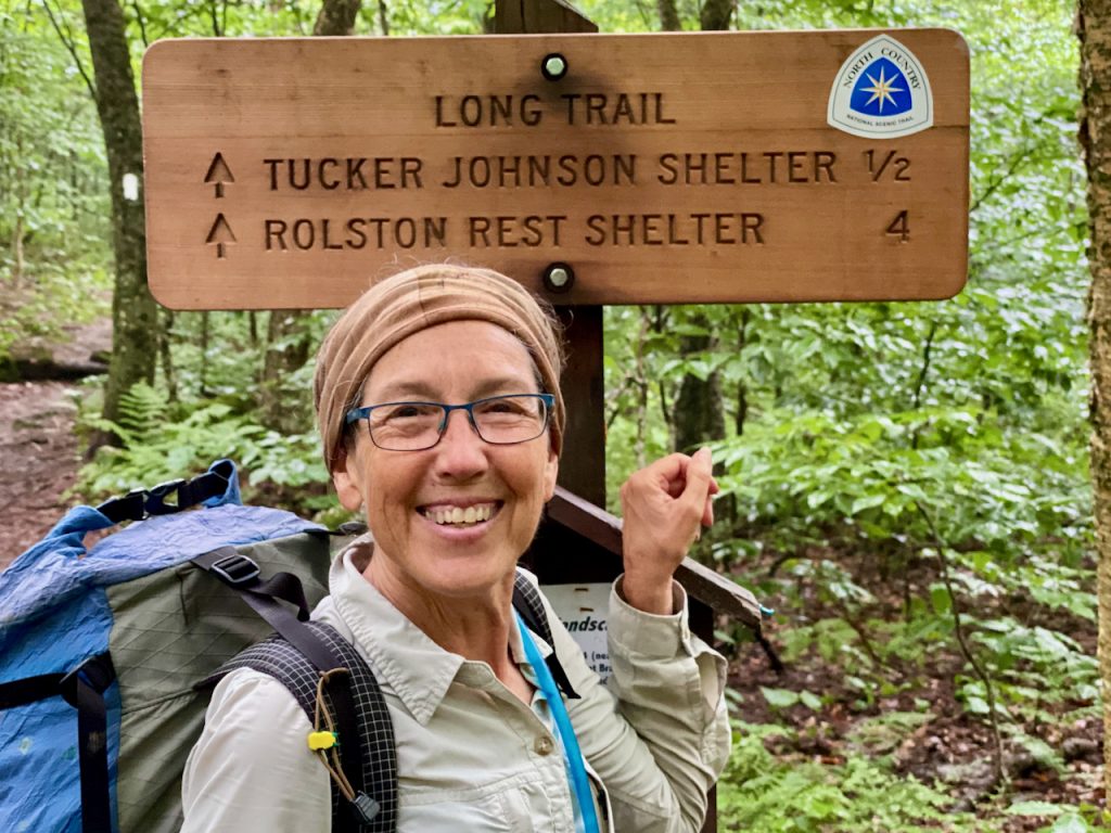
On Wednesday morning, Denali and I met at Maine Junction as I hiked up the Sherburne Pass Trail from Route 4. Our timing was great, though we did not set a particular timeframe other than mid-day. I had only a 20-minute rest at the junction before she magically appeared, descending the LT from the north. Denali’s smile was wide, and her spirit was high. The magic of the footpath in the wilderness had clearly infected her. On my way up, two separate times, I met a young person who had encamped with Denali the night before – HS graduate Henry and college graduate Sarah. Each gave me a good report on the lady I had left on the LT, alone, wet, and cold three nights before. They both had broad smiles while we passed, and I was comforted. Denali later regaled me with the story of Henry and her, coincidently meeting up with a contingent of young Middlebury College alums at their overnight mountainside reunion. Henry will now be applying to Middlebury.
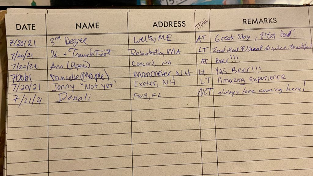
The return to Sherburne Pass and my car was a return to the reality of the modern, post-COVID world with a whirr of traffic on the major east-west truck route and corridor for tourism, US Route 4. One needs to sprint across the busy lanes these days. Of course, it was time for Denali to have a sit-down, hot meal, and we were not disappointed with our lunch at McGrath’s Irish Pub at the Long Trail Inn. This is a classic Vermont family business catering to LT and AT hikers for decades. When we dropped off some brochures and maps, Murry McGrath was psyched to hear about the NCT. Denali entered her name in the guestbook. She remarked that she was probably the first to mark NCT in the trail column. This, and her interaction with Murry and others, made me fully realize this woman is a walking force for good for the North Country Trail. She has fully embraced her mission of being a walking ambassador for the NCT.
After a fine meal and cold beverage, we departed in the Volvo and headed north. Without a pre-arranged plan and there being plenty of daylight, we allowed spontaneity to direct us and headed back to Sunday’s trailhead on Route 125 for Denali to pick up the trail west. A stop at the Robert Frost Interpretive Trail and a stroll along the accessible pathways and boardwalks was an unexpected treat. Reading my favorite Frost poems aloud as we wended amid the wetlands, trees, and open meadows along the short loop was fun. Reluctantly, we did not stay to ponder and head back down that most-traveled road for Denali to continue her wander.
Dropping the trail sprite off at the Oak Ridge Trailhead, I drove ahead to my former home-away-from-home, the Waybury Inn in East Middlebury, to secure a room for the happy North Country Trail traveler. Denali closed the gap on foot and arrived at the inn shortly. We used the convenient WIFI to view the interactive NCT map and reconnoitered the route to the Trails Around Middlebury (TAM). After determining that a road walk of Routes 7 and 125 was best, I dropped her at the official newly constructed leg of the TAM and North Country Trail south of Middlebury Village and set her free as she walked the three-plus miles back to the Inn. Once again, we departed, but this time, I knew that she would be in the lap of luxury, love, and kindness at the Inn. Her dinner choice was the Mushroom Wellington, which I’m sure was a welcome change from the trail food and cookies I gave her on Sunday.
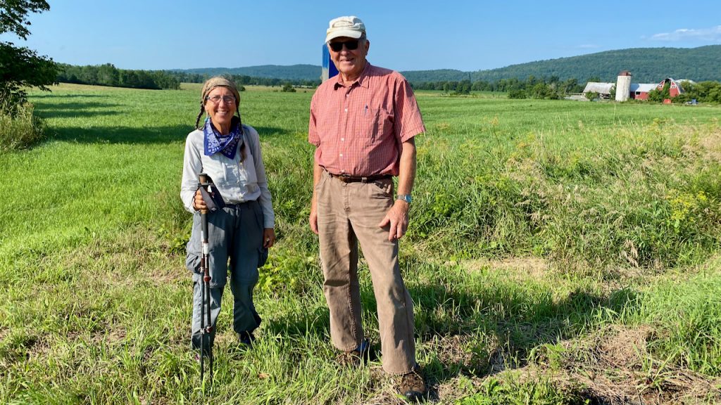
I left Mary in good hands at the Inn and with our friend John Derick, who once again provided his courteous shepherding of Denali along her way on Thursday as she traversed his love – the TAM. I returned to the several other things that occupy my day as a not-very-idle retiree, but with a hankering to return to the trail. Later that afternoon, I joined friends with the Slow Hikers in Transition club for a hike up Timberline at Bolton Ski Area. What fun to keep my local hiking friends abreast of Denali’s and my adventures, knowing then that I was determined to reconnect with her.
So, with the help of John, we planned a final day hike of Vermont from Weybridge to the Champlain Bridge and New York State border. Denali spent the night in an undisclosed location in Weybridge in her comfortable tent. She arose early to walk the remaining section of the official NCT route in Weybridge across the lands of Monument Farms Dairy to Prunier Road, where she met John. They then drove to the New York State Campground on Lake Champlain, just opposite the Vermont side of the Champlain Bridge, the NCT link between VT and NY and the former eastern terminus. Thankfully, the staff graciously reserved Denali a site, and we spotted my car there. John returned us to Prunier Road, where we began our day-long walk back to NY, the campground, and the Silver Bullet (Volvo).
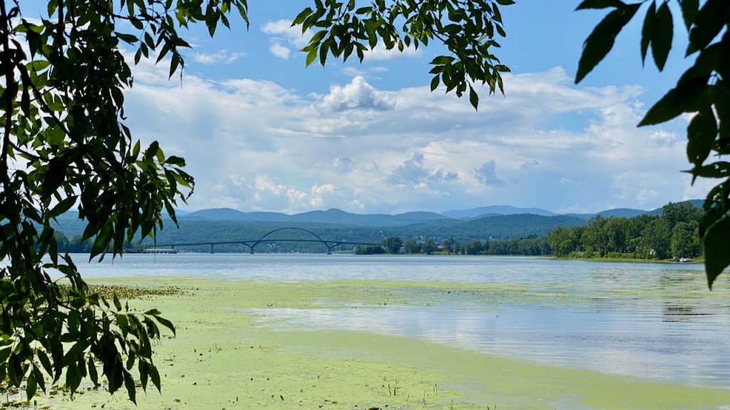
We warmed up fast as the sun rose, and our pace quickened along the quiet town roads of Weybridge, crossing the Lemon Fair River, until we arrived at the first actual trailhead. We deviated from the official NCT route in the spirit of a national scenic trail experience. We entered the Vermont Department of Fish Snake Mountain Wildlife Management Area (WMA) access on the east side of Snake Mountain Road. The forest trail ascents up the east side of the mountain into the WMA and connects with a very active recreation trail from the west side, a former carriage road to the top of Grand View, once a hotel site. We chose this route and lunchtime destination for its stunning view of the Champlain Valley, its like-named lake, and the majestic Adirondack Mountains beyond.
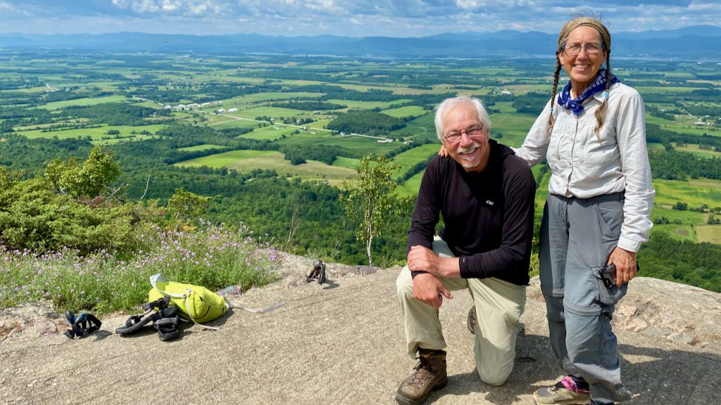
My Vermont friends aren’t keen when I remark that Vermont is so beautiful because it has such a great view of New York, a view that we often have as peak baggers in the Greens. Turkey Vultures lazily ride the updrafts along the cliffs of the Snake Mountain ridge that pokes up several hundred feet above the valley floor below. Denali was delighted with the deviation from the official road route around the mountain and advised patience with the hope of making our route officially accepted. Her sage advice on land manager relations has been well-honed with her work with the Florida Trails Association and affiliated experience working with the greater National Trails community. Say nothing of her 15,000 plus miles walking the walk.
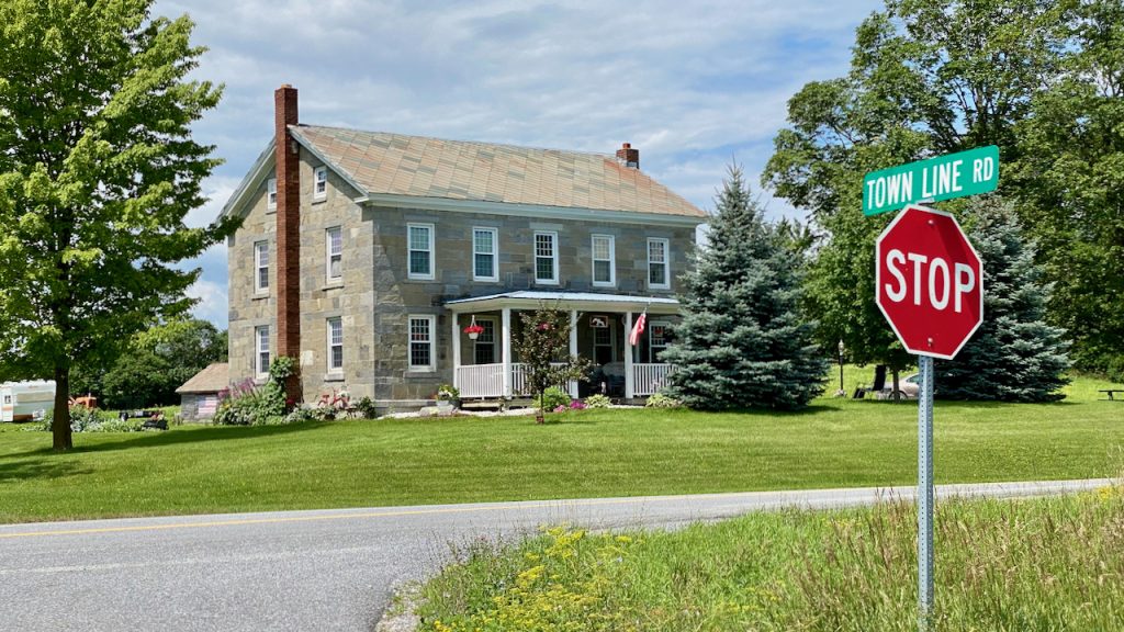
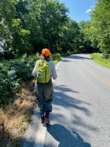
Speaking of walking, that we did! It was another 8.5 miles of road walk to the Champlain Bridge along the open stretch of the Champlain Valley through Addison County. We descended to Mountain Road on the west side and then headed due west on Town Line Road. With no curves and only a few dips and crests, we had continuous, magnificent, sweeping views of the farmland countryside and approaching mountains in the distance. We made relatively quick work of the long but not-so-winding road, taking only one break for a snack and rest. Only a few cars passed us as we sat in the shade along the road like two vagabonds. Soon, we found ourselves back on Route 125. CAUTION! This is the most perilous section of the entire Vermont route due to the narrow roadway with no shoulder, many curves, and traffic. The only compensation is the excellent views of Lake Champlain adjacent to the road and the welcome sight of the bridge in the distance. Thankfully, this is a relatively short section of approximately a half mile.
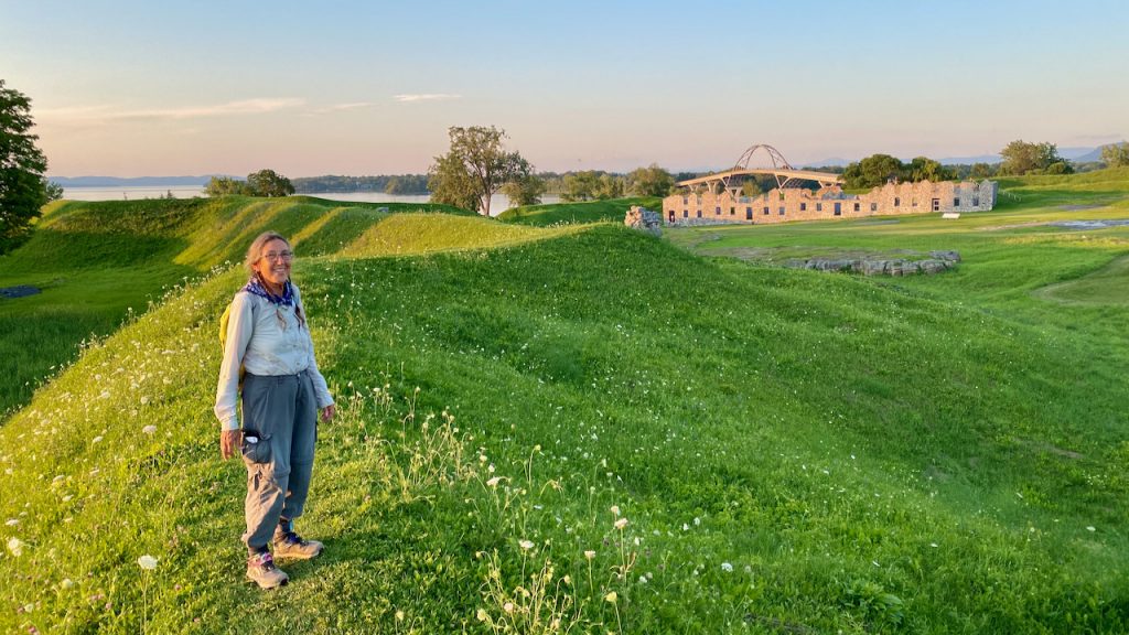
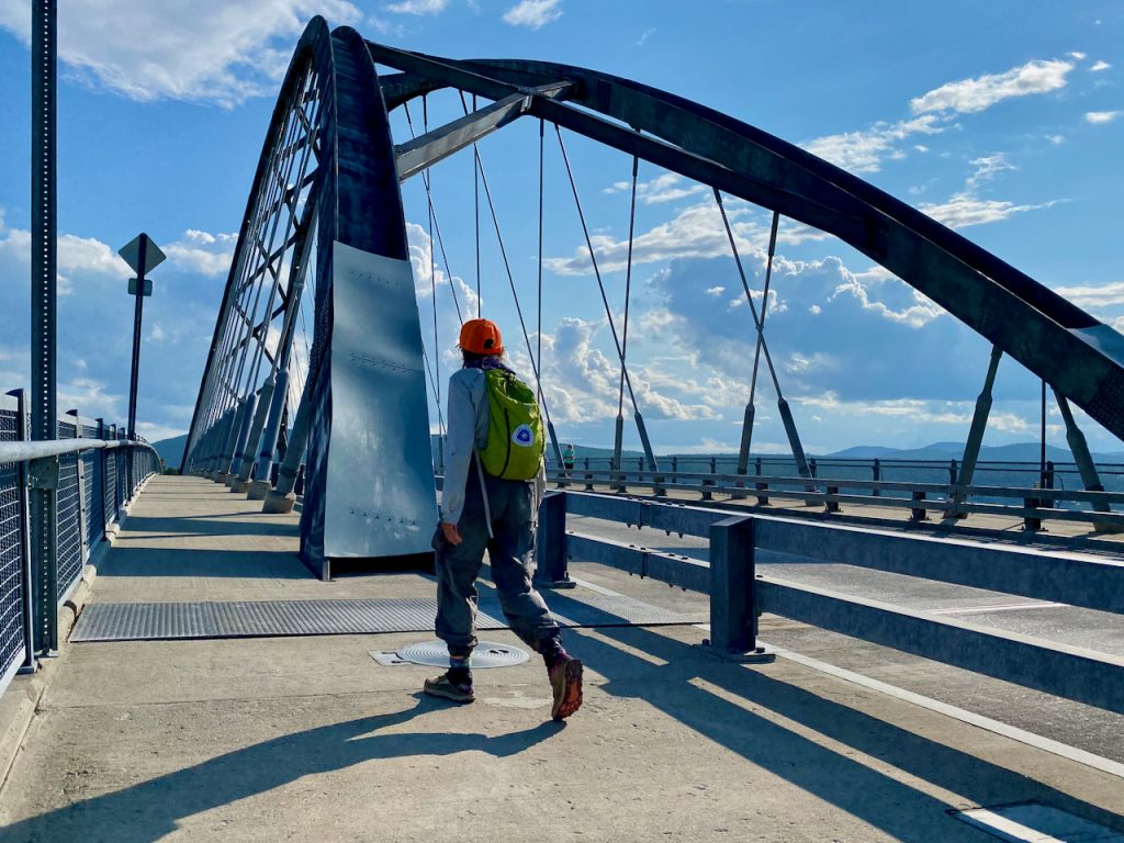
We had now entered a very historic area, Chimney Point in Vermont and Crown Point in New York. We rested our weary feet before completing our journey and touring the site. We sated our hunger with an early dinner at the Bridge Restaurant, where the food was great, and the service was welcoming and friendly. We drank a gallon of water, and I had one beer – Yay! Fully fortified, we were off to visit the fortifications and historically significant features of this narrow chokepoint of Lake Champlain, starting at the Chimney Point State Historic Site Museum on the Vermont side and then taking a sunset walk around the remains of the French and British forts at the Crown Point State Historic Site in New York. I regaled Denali with stories of the history of Vermont as we mounted the eastern side of the Champlain Bridge and crossed into New York under its graceful arches. Great nations vied for control of the continent, embroiling the indigenous peoples, as territory swayed based upon the control of this point, ultimately resulting in the capture and control of the British Crown Point Fort by Seth Warner and the Green Mountain Boys during the early part of the American Revolutionary War.
For the third time, I was leaving Denali after spending the entire day walking and traveling with her. It is hard not to get to know and admire someone after such a bonding experience. I know our trails will merge again as I head west on my annual summer tour of youth music education (DCI.org) through New York, Pennsylvania, and Ohio. I have sent word ahead to other North Country Trail folks in New York, including my two sisters, to be available to boost her along her long and winding trail through the Adirondacks, Central New York, and the Finger Lakes. I have been touched by her magic, and she will be in my thoughts as I work with others on making the North Country Trail in Vermont and beyond not only the longest but the best National Scenic Trail.
This morning, I saw this smallish, 60+ lady in sneakers carrying a pack, sprinkling a magic fairy trail dust everywhere she stepped. I awoke and felt good. Happy trails, Denali.