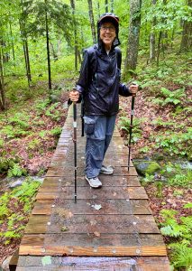
July 18, 2021
It was a day in the Green Mountain National Rain Forest. Intermittent, sometimes strong and steady, the rain did not deter our progress along the Oak Ridge and Moosalamoo Trails. Long-distance hiker Denali (trail name) and I were off on her 4,700-mile mission to complete the North Country Trail. We were traversing the Moosalamoo National Recreation Area, near Ripton, Vermont, a proposed route of the newly connected to Vermont, North Country Trail. The Moosalamoo NRA is within the Green Mountain National Forest under the management of the US Forest Service and the auspice of the Moosalamoo Association.
To our great pleasure, these cross-Moosalamoo trails have been thoroughly upgraded with new switchbacks, buttered-in tread and banked turns for biking. It was like we were on our own personal highway in the wilderness and we made lightening-speed. We spotted the car at the campground, more or less the mid-point. John Derick, the father of the Trails Around Middlebury (TAM) gave us a ride to the trailhead starting point on Route 125 in East Middlebury. The TAM is managed by the Middlebury Land Trust (MALT).
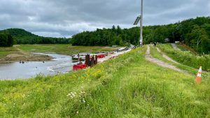
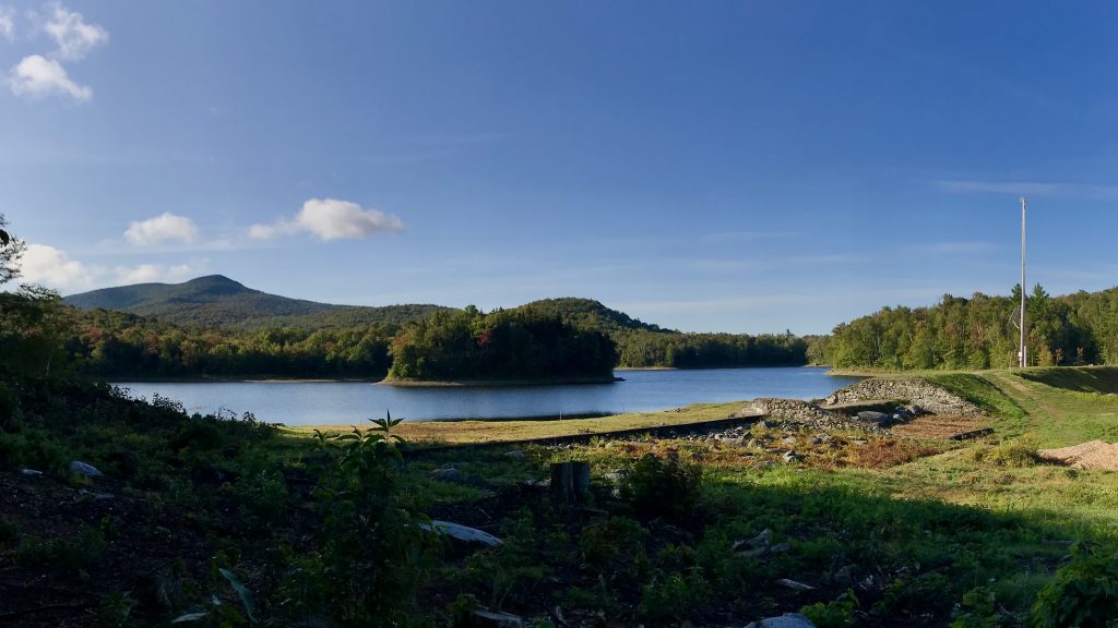
After approximately 9.2 miles, we took a welcome break at the car and then headed further southeast toward the Sugar Hill Reservoir on the Horseshoe Trail. This is also a leg of the statewide cross-country ski trail – the Catamount Trail managed by the Catamount Trail Association (CTA), that also traverses the National Recreation Area. Once at the Goshen Dam, we discovered that the route across the dam was closed while repairs are being made. However, we noticed men in hard hats on top of the dam conferring. We strategically chose Denali to approach them with a friendly hello and request to cross.
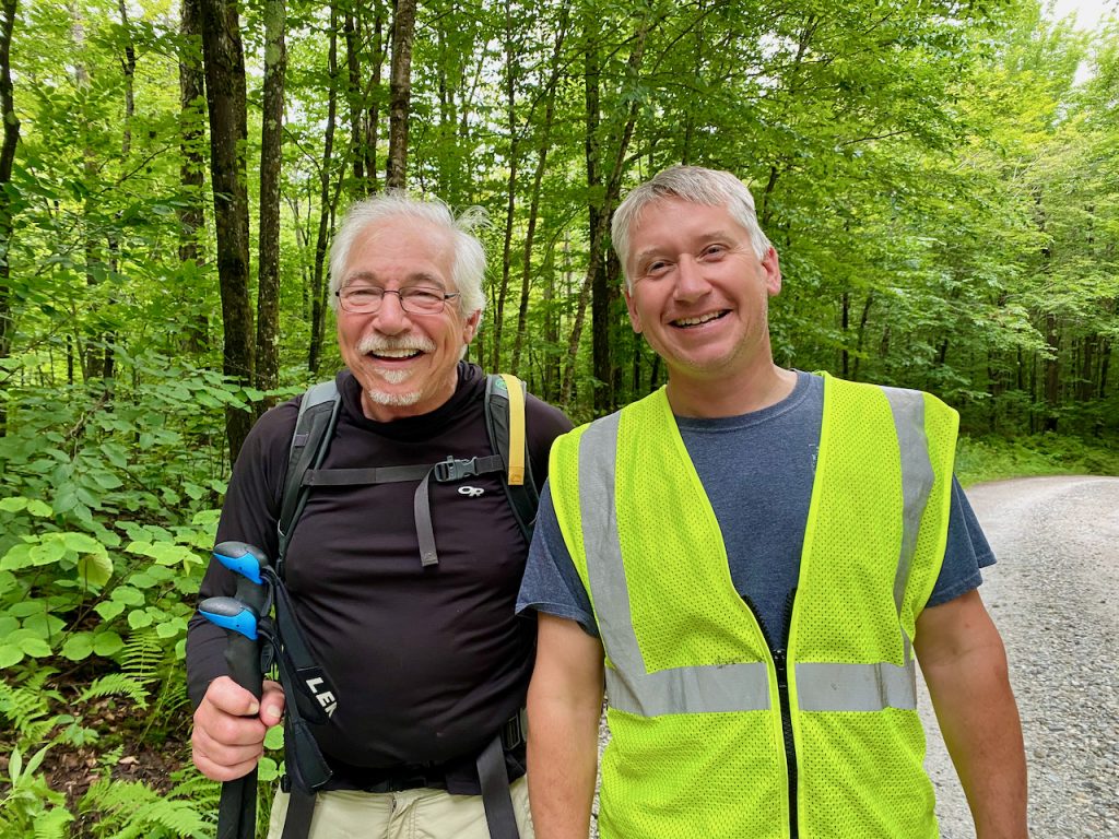
She waved my forward and the two gentlemen escorted us across the dam and out past the multitude of construction equipment and materials in the lot and along the access road. It is not a safe place to hike otherwise and should be avoid. Lo and behold it was also a small-town Vermont episode, as our escort Jason, is a good friend and former colleague at Sugarbush Resort, Warren, VT. Jason helped the Mad River Path section along the resort snowmaking pond become a reality. A good hug cemented our credentials as we passed the many people working on Sunday due to the rain.
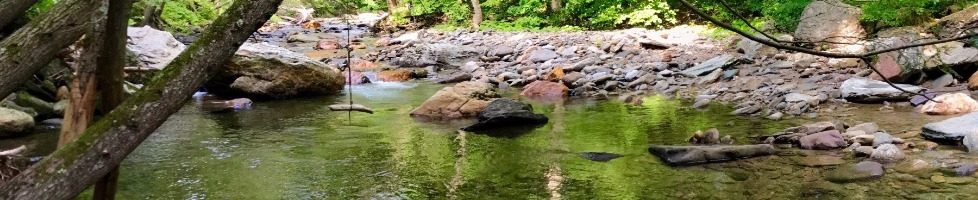
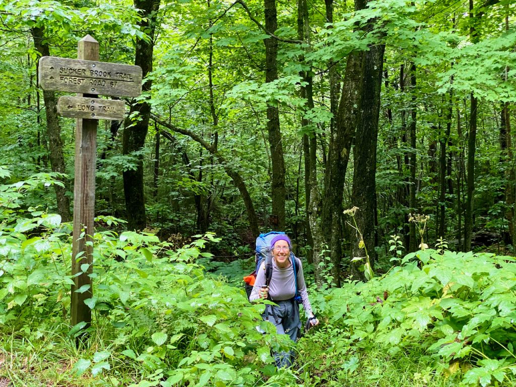
Once we picked up the Sucker Brook Trail, we experienced the full effect of the heavy rains as the tread was deep in standing water and mud. Denali’s light and spritely steps seemed to float over the terrain as my boots would often sink to the ankles. Thank you to my new Lowas, right and left for keeping my feet dry all day. The last mile was the hardest as the trail ascends up to the Long Trail, our destination. The Long Trail was established by the Green Mountain Club in 1903, making it the first long-distance hiking trail in the country.
Giant Hogweed created us at the entrance to the Joseph Battel Wilderness. The active streams were ankle deep with fast running water as we gingerly crossed them with all four points, feet and poles. After a short rest at the shelter to enjoy a beverage and snack, with a hug I was on my way back down to the car. Denali was left alone to shiver and contemplate as there were no other LTers there when I left. My return took a different route. I wanted to check out the condition of Brooks Road FR67. From Sucker Brook, I hiked the high and dry road to the junction of the Goshen Dam Trail back to the Horseshoe Trail, to the campground, arriving at 7:30pm. I was accompanied by persistent rain the entire way back. I even got wet again while changing into my dry clothes and packing up the wagon. The eleven-hour day-hike on my sore feet was somewhat assuaged by my sandals and the cold beer in my cooler. The cruise back to the Valley and my welcome couch was dreamlike as I ruminated the days trek in my mind, thinking often about Mary up there, cold and alone. I turned on the heat in the car to dry off and shake off a slight chill, feeling a little guilty.
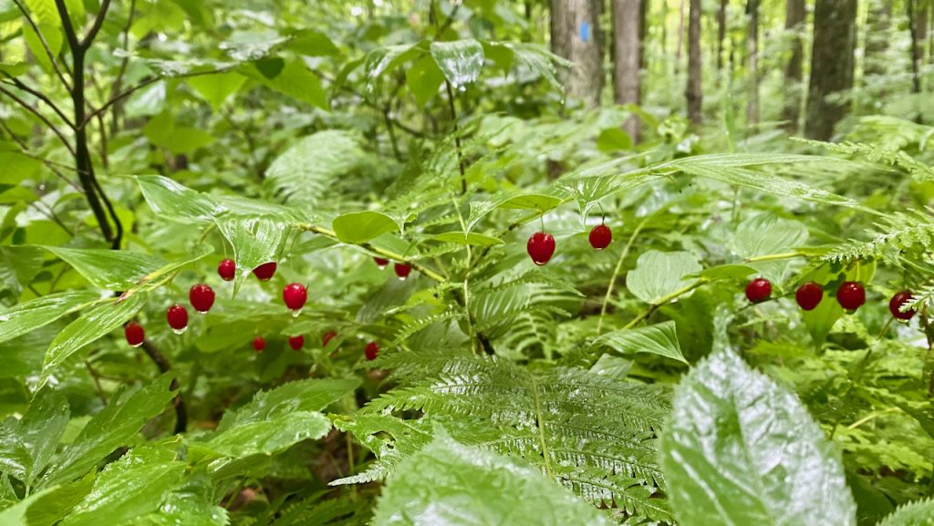
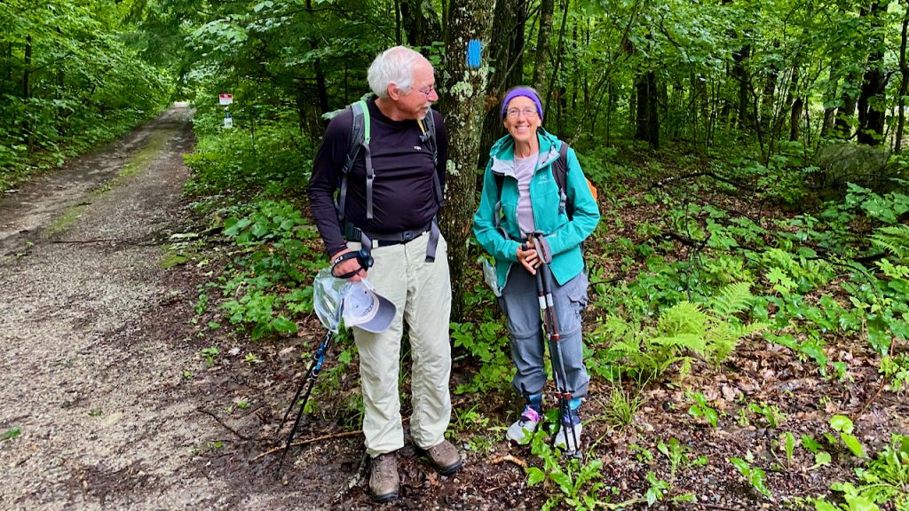
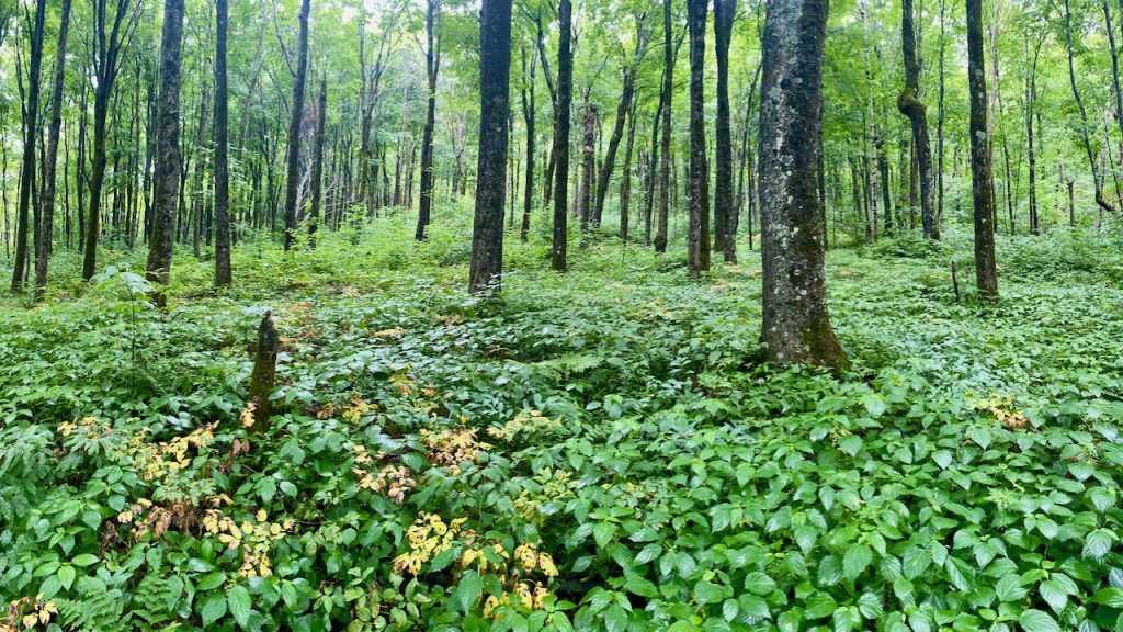
Denali was put in touch with me by John to offer some advice on her route. She estimates that she has traversed over 15,000 miles while backpack hiking; this is her second time on the LT. Knowing that the trail route is not well established yet, I offered to pick her up at the airport in Burlington, and to also guide her on the route that I took in the fall of 2019 (see my blog series). Though I was the one providing the good shepherding, I constantly thanked Denali for coming and taking me along with her on such a wonderful hike. I have never been disappointed hiking in the rain. Moosalamoo is a very beautiful forest with open glades, tall straight trees and a plethora of ground cover. Ferns, nettles, jewelweed, hobblebush, and more covered the floor in a sea of green. The mid-July fruit was in full glory and the ground was interspersed with ideal specimens of fungi. What a magical place to share with someone like Denali. Our hearty conversations were segmented between long stretches of quiet reflection and a steady pace. She and I have much in common and it was great to share and learn. Maybe I was too into sharing as my robust enthusiasm was fully on display.

Maine Junction, the junction of the Long Trail and the Appalachian Trail, is now also the established eastern terminus of the North Country Trail, as envisioned by the trail founders back in the early days. Our plan is to meet again at Sherburne Pass, Route 4 near the trail nexus in three days to shuttle Denali back to our starting point. She will continue west through the towns of Middlebury on the TAM, and Weybridge across the farmlands of Monument Farms Dairy, then up over Snake Mountain and west to the Champlain Bridge on Town Line Road bordering Bridport and Addison. The TAM and Weybridge Blue Trail have official met the criteria for the North Country Trail and she will find the blue blazes and good trail signage to guide her.
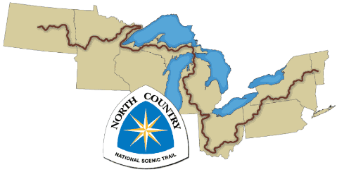
The idea for the NCT was born out or the National Trails System Act of 1968 that acknowledged the importance of the AT, Pacific Crest Trail and other nationally significant trails. There are dozens of national trails with only eleven National Scenic Trails that are overseen by the National Park Service and non-profit partner associations. The North Country Trail was established in the mid 1980s by a group of committed volunteers in Michigan who saw a need for a trail connecting the northern boarder states. The goal being to establish a connection between the Lewis and Clark Trail in west in North Dakota and the AT in the east across eight states: ND, MN, WI, MI, OH, PA, NY and VT.
Now a reality in Vermont, the Middlebury Area Land Trust, in coordination with Stephanie Campbell, NCTA Regional Trails Coordinator, are actively working with the Green Mountain Club, US Forest Service, Moosalamoo Association and the Vermont Department of Fish and Wildlife to formalize the Vermont route. I am honored to have been appointed to the NCTA board of directors in September 2020 and look forward to representing Vermont and its full adoption of the Nation’s longest National Scenic Trail. The sun rises first on the NCT in Vermont. Meanwhile, I will keep you posted on Denali’s journey and other posts as I continue to explore the North Country National Scenic Trail.